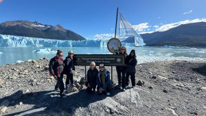
In January, six of us decided to hike the famous Tour de Mont Blanc trail in the Alpes. After research and discussions with Alpine Exploratory, our travel agent, we decided to only hike the northern section. Seven days, around seventy miles, from Courmayeur in Italy to Chamonix in France. August 1 was our third day of hiking TMB: La Fouly to Champex. 9 miles, 1,940 feet elevation.


After a good night sleep and breakfast buffet, we decide to leave as soon as possible as there is rain in the forecast that afternoon. Ideally, we want to try to get to our hotel before the rain starts. When we leave the hotel, rain clouds are already hanging low over the mountains, and it threatens to rain. In order not to get caught, we decide to put on rain gear and cover our packs with the rain protectors.
La Fouly to La Kabana
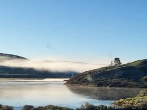
We walk through the still quiet village until we reach the little TMB sign. We cross a bridge over the river and make a turn onto a broad gravel lane that follows the river. The sky is getting lighter and so far, the rain stays away. Soon we enter a trail that leads into the woods. We pass meadows, bridges and a rocky gully with chains to guide us, before we reach La Kabana, a little coffee and snack shack. Tammy and Seema decide to stop for coffee. Although tempted, the rest of us decide to continue, in anticipation of the rain. However, we do stop for a picture of our backpacks, taken by a friendly fellow hiker. Later, when we look at the picture, we realize he took a selfie of him and his friend as well. We have to admit, it’s funny.


La Kabana to Issert
We pass through the village of Praz de Fort. Across the river, we walk past more houses and several, what looks like deserted barns. When looking it up, we learn that those will be filled with wood in the winter. On the first day we had determined that Maureen’s mountain animal is an ibex. I take a picture of a little pony, brown with blond mane and tail and decide that that is my mountain animal. We cross another bridge and enter the town of Issert. We are hungry. So, we stop at Cafe du chatelet and order ham and cheese sandwiches to go. We eat them sitting on the side of the road, and all agree, these are the best ham and cheese baguettes ever. And guess who walk by when we are eating: our cheeky photographer and his friend. We tell them it was kind of genius.


Issert to Champex
Energized from the delicious sandwich, we start the final stretch to Champex. This is also the part with the most incline, 1,500 feet in roughly 3 miles. The weather has turned nice, so rain jackets no longer needed. To distract us, the route card tells us to look for delightful sculptures along the way. The trail starts steep and turns into a number of zig-zags. We find several sculptures and it does help. We take a break at a picnic area with views over the valley below.


The path continues back up, before we finally arrive in Champex Lac. It is still early, and the weather has turned nice, so we agree we deserve a drink at the lake side Mimi’s lounge. Sipping on Aperol Spritz with views of the lake, I realize, that life does not get much better than this.


Orsieres
When we booked our trip, hotels in Champex and Champex Lac were booked, so we have a hotel in Orsieres and we have to take the bus down. Hotel Terminus is good and the location, next to the bus station is great. However, next time I would definitely prefer to stay in Champex Lax. We do have a fantastic dinner in the hotel restaurant, Le Quai de L’ours. After the not great dinner in Elena, the better buffet in La Fouly last night, this is a step up. After this meal, we are in a food coma and ready for a good night sleep as the trail is waiting for us again tomorrow.


All photo credit: Liane Aihara, Mariel van Tatenhove, Mauren O'Gorman, Seema O'Dwyer, Tammy Bacca, Vanessa O'Keeffe